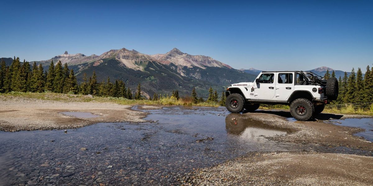
I’ve been doing some Off-road Jeep adventures for a few years now and have been wanting my wife to go out with me. She sees me watching YouTube videos at night and she always says she wouldn’t like the bouncing around. But I was all but certain if I just got her out there she would enjoy it.
Early August was our 25th Anniversary, so last spring, we were kicking around ideas of where to go. I threw out Glacier National Park and she countered with Banff, but then she said she didn’t want just to tag along as I take pictures. When on a trip if I’m not behind the wheel of my Jeep Rubicon, I’m taking pictures. I knew she wouldn’t go for Moab in summer (too hot), so I then threw out Telluride; I didn’t mention there were 5 Jeep Badge of Honor Trails nearby. She did some research and saw how beautiful it was, so Telluride it was.
Then I set out planning how to get her ready for the trails in the San Juans. I knew most, if not all of the trails had high narrow shelf roads, and my wife does not like heights. Plus one of our daughters have stoked her fears with a very dramatic (but highly entertaining) story about our experience on Rose Garden Hill. She calls it Cliff, Roll, Death. She likes to tell we were near death the entire time, and yet we drove out completely unscathed.
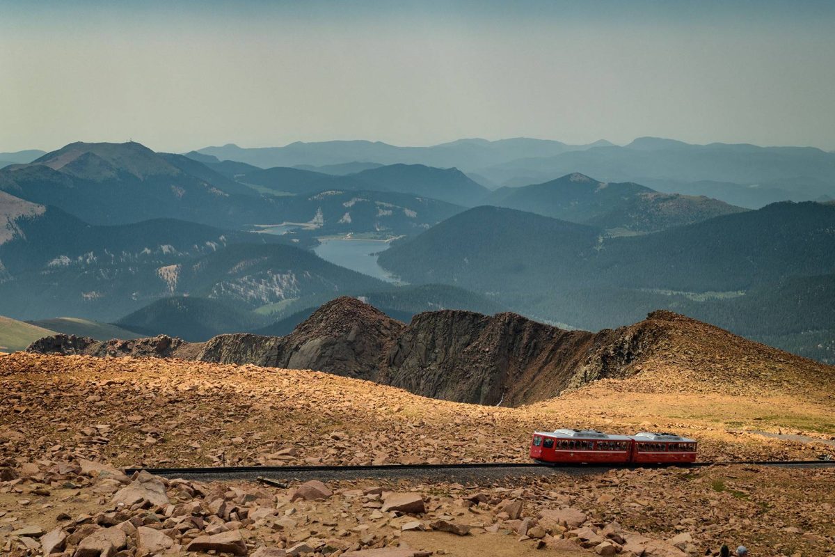
For the trip out I scouted a route that would hopefully ease my wife into the trails. On day one we left early on a Wed morning and drove to Colorado Springs and stayed overnight in Manitou Springs, at the base of Pikes Peak. The next day we drove to the top; I knew that would be a twisty windy road with some shelfy spots. She took that one better than I expected, which was encouraging.
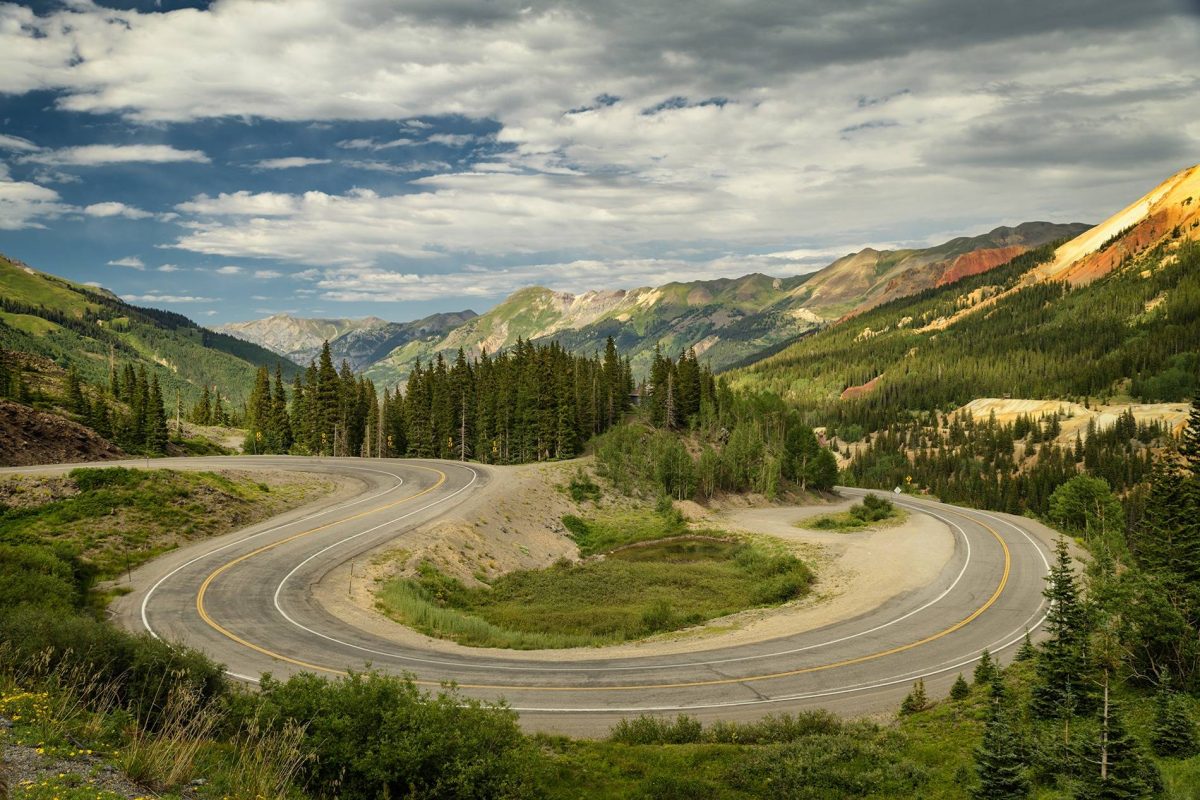
We then set out for Montrose, CO. We headed west on US 24 to Buena Vista, which turns north. We took that up to CO 82, which goes past Mt Elbert, and then up to the Continental Divide at Independence Pass (12,095 feet). This was the first true (paved) shelf road. There are some stretches where the road is very narrow with no shoulders or guard rails and several hundred feet down. These got her a little nervous, but the beauty of the scenery always won out over the fear. I was very encouraged.
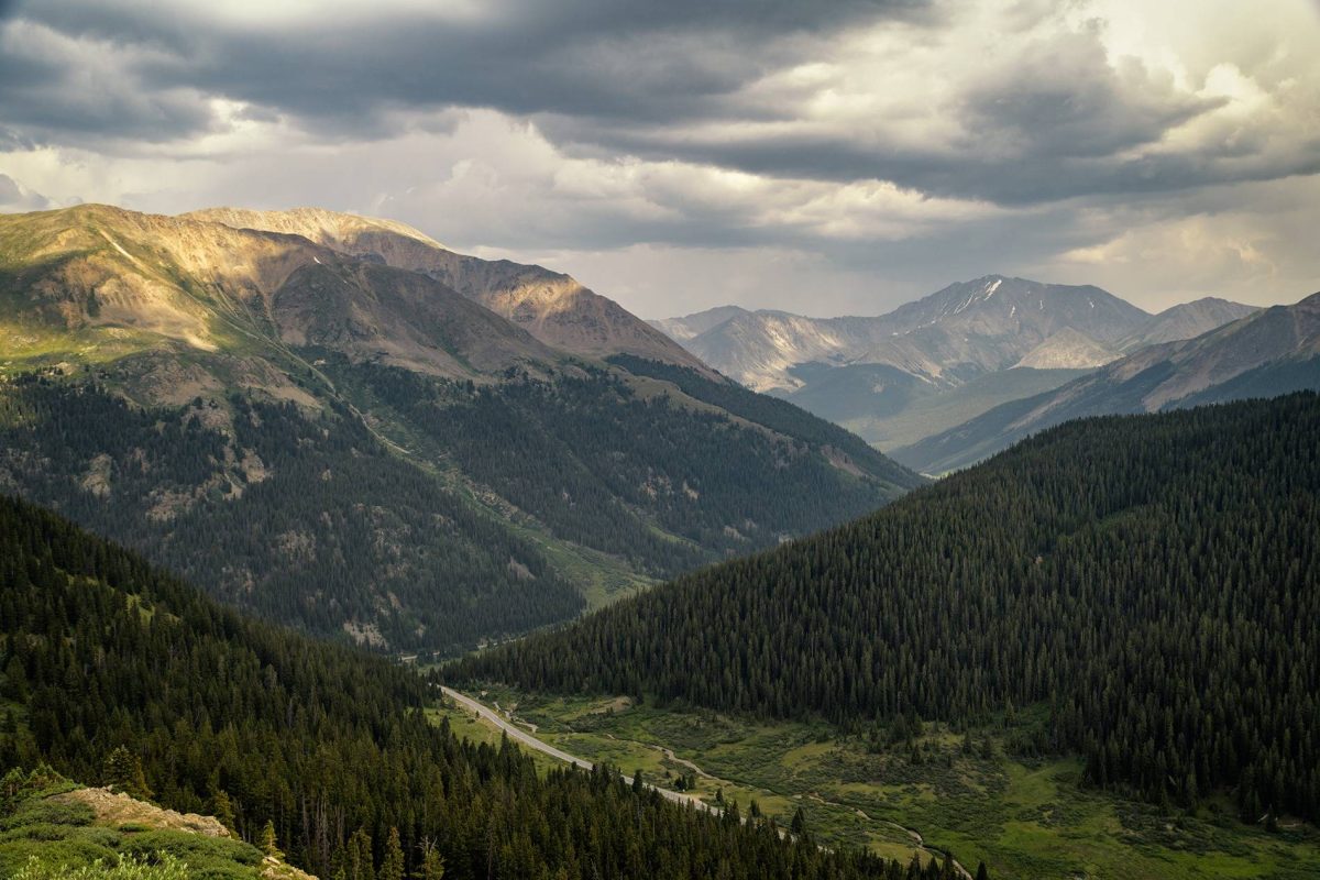
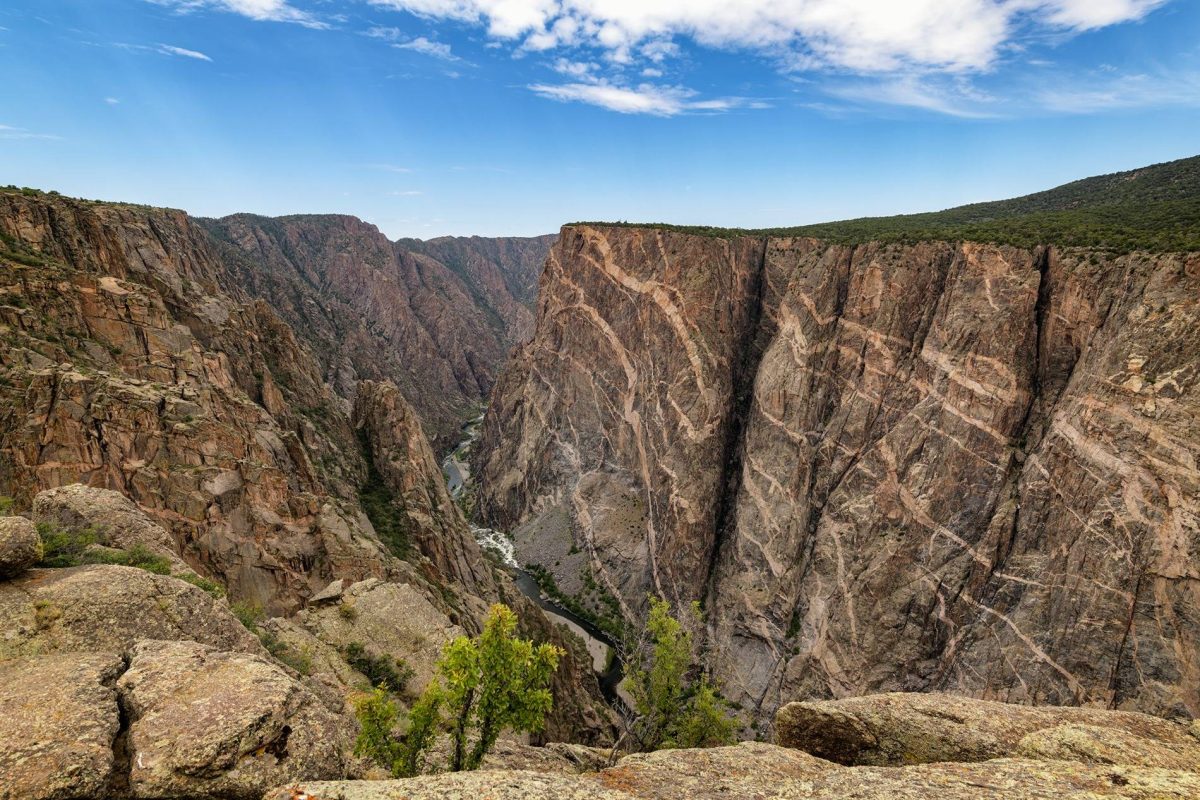
From Independence Pass we drove up CO 82 through Aspen to Carbondale and then headed southwest on CO 133 to Delta and then south on US 50 Montrose. The beauty of this route was amazing!! I’ve lived most of my life in Minnesota, and when I tell people, they all say, “Oh, the lakes are so beautiful!”. I say, screw the lakes and give me the mountains!! Had I let the photographer in me win out, it would have taken a few days to get to Montrose, but we had to be to Telluride on Friday, so I just drove, and we were both in awe of the beauty. On day three, we visited Black Canyon of the Gunnison National Park. It was breathtaking!! I may have to take a detour for a day or two on my next trip to Moab.
As we drove up the highway to Telluride on Friday we were again blown away by the beauty. My wife pointed out Ingrahm Falls and said look at that cool waterfall way up there. I wanted to tell her that we were going be driving right under that waterfall later in the week, but I didn’t want to freak her out so I just nodded and said “Yup”. At dinner that night I let it slip about all the BOH trails and she jokingly accused me of kidnapping her and dragging her along on one of my Jeep trips. When I told her how Black Bear Pass came down a series of switchbacks below that waterfall that was way up there she didn’t immediately respond “Oh, hell no!!” so again, I was very encouraged.
Saturday we took it easy and strolled around Telluride. We took the Bridal Veil hiking trail to the first waterfall, which was good enough for both of us; we were both still not fully acclimated to the elevation. We then took the free gondola up to the ski resort and explored around there for a while.
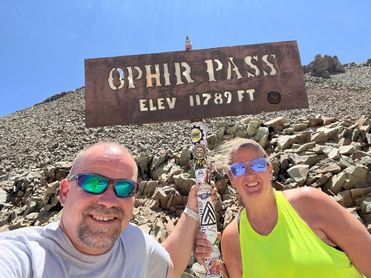
Prior to the trip couple forum members @SadRobot and @arnie_mueller invited us to wheel with them as they were going to be in the area at the same time. Their plans were to do Ophir Pass and Black Bear Pass on Monday. I didn’t want my wife going in completely oblivious to what the trails were going to be like so on Sunday we did Ophir Pass. On the way to the trail we took a detour up to Alta, a ghost town where Nikola Tesla executed the first industrial use of alternating current electricity. The road up to Alta has a narrow shelf section immediately after leaving the highway. Driving up we got about 80 feet above the highway below and my wife says “I’m not doing Black Bear!!” It was a bit discouraging, but we continued.
After Alta we headed to Ophir Pass. On the way up, my wife jokingly asked, “Why does the cliff always have to be on the passenger side.” We made it to the top and she was giddy that she had survived and again was in awe of the beauty. We then drove down to the Million Dollar Highway and up to Ouray. Again we were both blown away by the beauty. We stopped for lunch at the Ouray Brewing Co. and got this cool beer can glass.
On the way back to Telluride we took Last Dollar Road. With everything we had seen so far, Last Dollar Road was a bit disappointing. It would be really fun if it was wet, and it would probably be really cool during the fall when the Aspens are turning. But during the summer, when there hasn’t been a lot of rain for a while it was kind of boring.
On Monday morning we were meeting @SadRobot and @arnie_mueller at the Ophir Pass trailhead at 7 am so I set the alarm for 6 am. I wasn’t sure my wife would be willing to do Black Bear and I wasn’t going to leave my wife alone for the day. The alarm went off and I started playing with my phone. A few minutes later she got up and I thought she’s really going to do this; I was super excited. We got to the trailhead just after 7am at the start of what was to be an epic day.
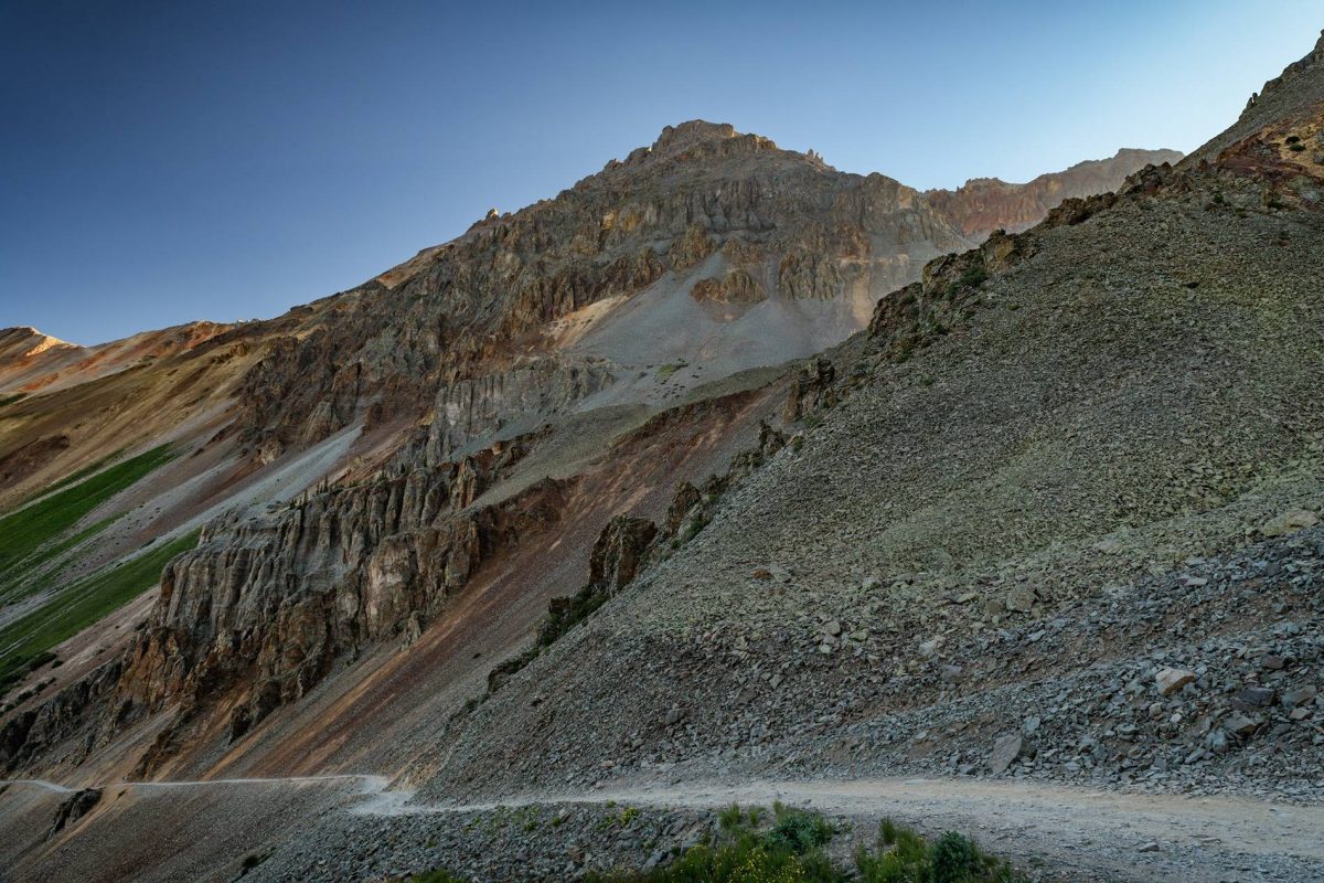
We headed up Ophir and stopped at the top for a few more pictures. I love the layers you get in the mountains when the mountains and haze are back lit by the early morning sun. Then we headed down to the Million Dollar Hwy and north to the Black Bear trailhead.
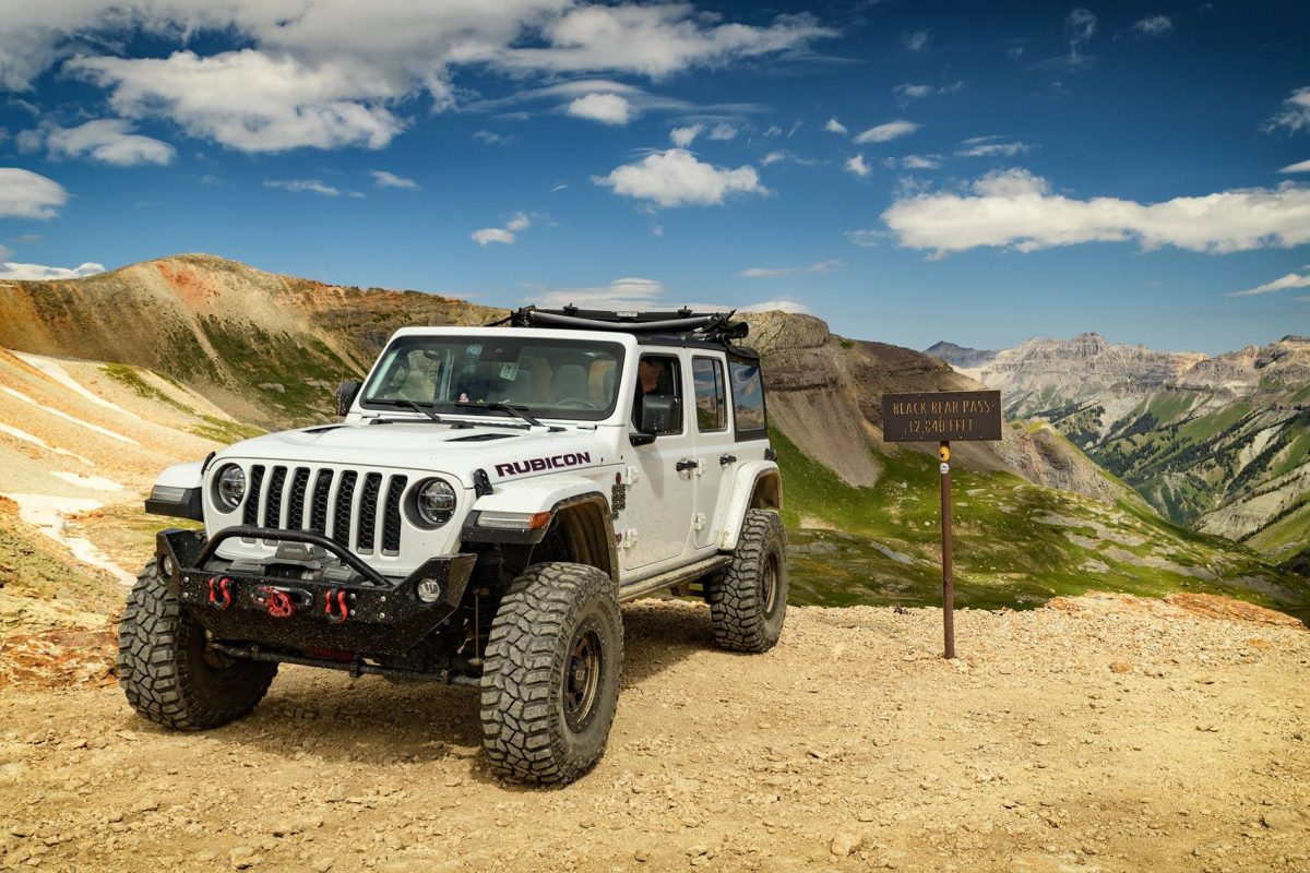
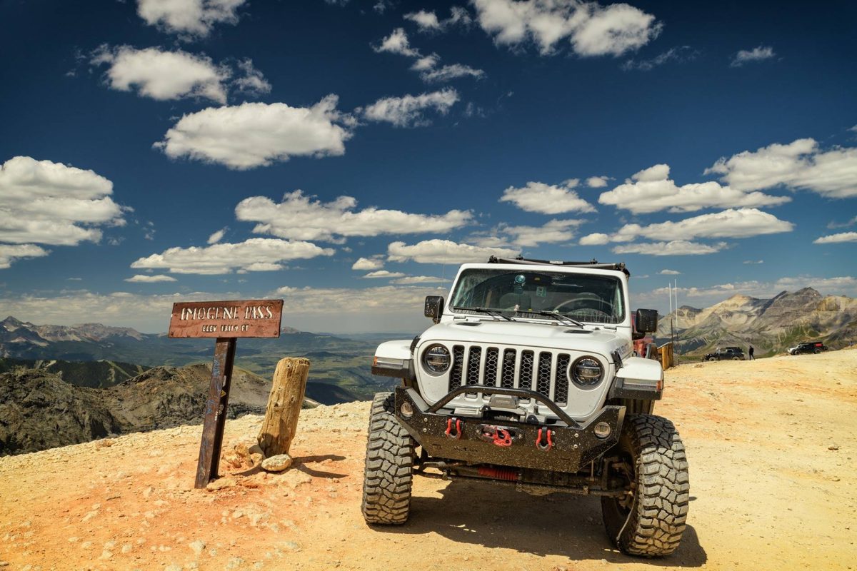
Aside from the never ending scenic beauty the route up to the top of Black Blear Pass is rather uneventful. It’s just a fairly steep narrow climb. I imagine now with the Telluride side of the pass closed there’s a lot more two way traffic to contend with. The view from the top of Black Bear Pass is amazing. A lot of people say Imogene is more scenic, but you’re really just splitting hairs at that point.
Does anyone know where the one-way section really starts on Black Bear? IMO it really should start at the summit. The first mile or so down from the summit is pretty narrow shelf road with minimal opportunities to pass. Luckily on our trip no one was heading back up. I ask if anyone truly knows where the one-way starts because as far as I can tell it isn’t marked. For those that have done the trail I assume most of you saw the sign that says “Began One-Way” (I wish have gotten a quick pic), but where did it begin?
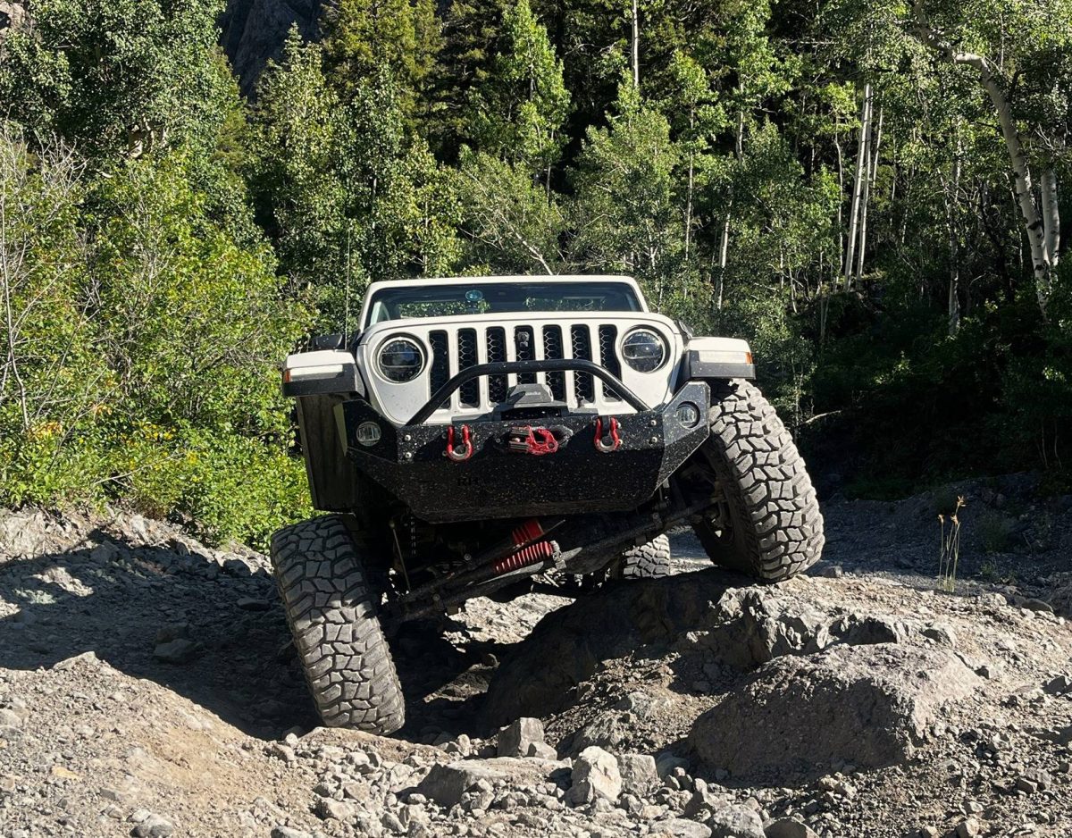
It’s a bit further down from this sign where you come to the first real obstacles, the three tippy spots. These are the only parts that I was really worried about; I’m not a big fan of going off camber. Most reviews mention the tippy spots and tell you to be careful, but the pictures make them look like a piece of cake. So why the warning then? Well as per usual pictures and videos don’t do these spots justice at all. They are actually pretty big and if you take a stupid bad line you could get into trouble, especially with an IFS vehicle. As long as you get out and study the lines you shouldn’t have any issue. On the lines I picked out and was spotted down I never got past 22 degrees roll, so not bad at all.
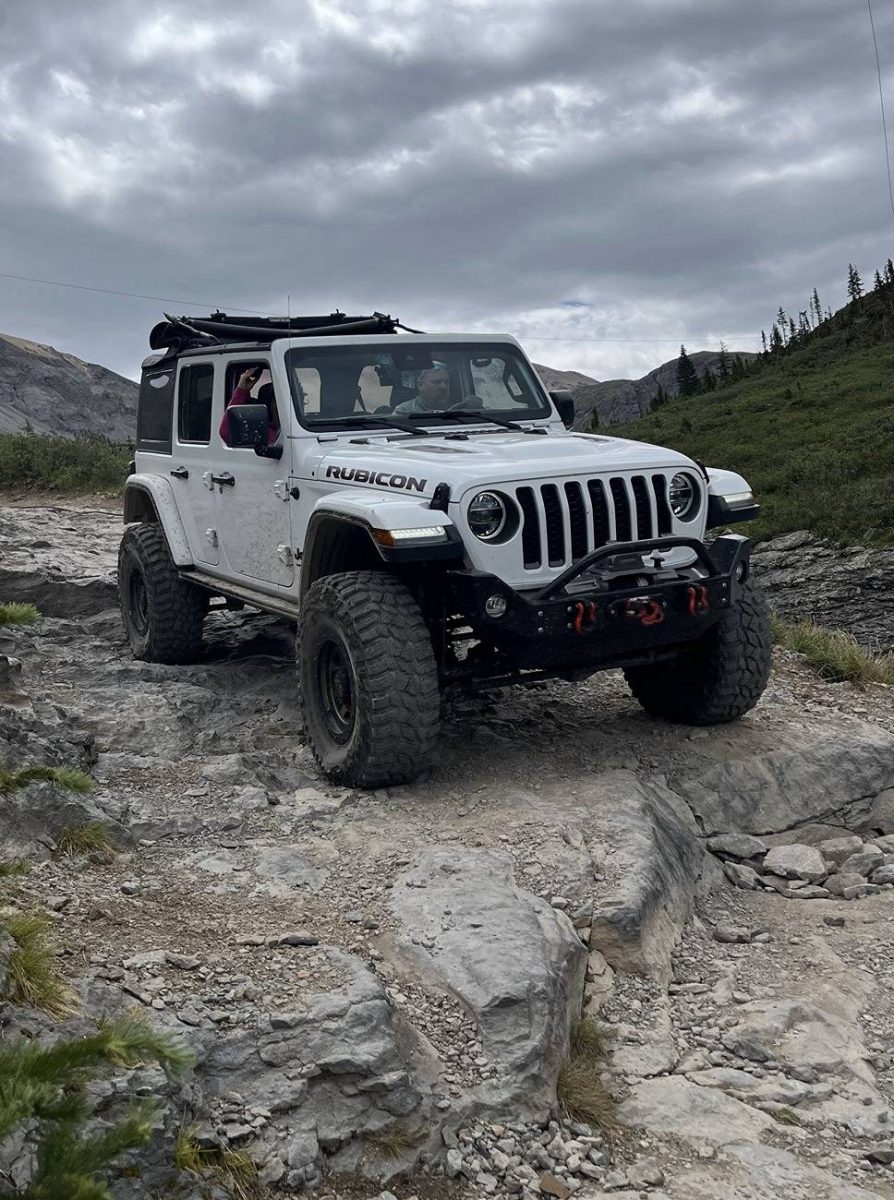
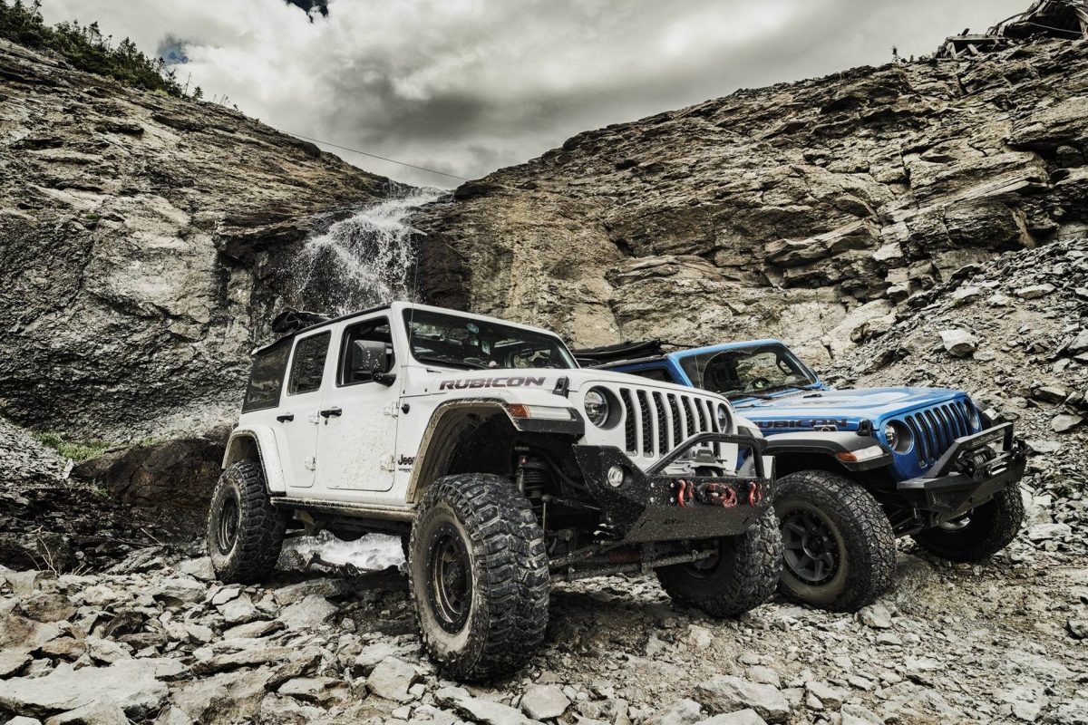
I was shocked at how rough The Steps section is. On videos the steps just look like some loose shale bumps. I wouldn’t really call them steps but they are anything but small. The aren’t difficult to get through, I was just surprised at how big the holes are. Rigs with lower than average (for a 4×4) ground clearance will definitely scrape here. The view from the steps is one of the coolest on the trail. You have Ingrahm Falls on your left and Telluride WAY down below in the valley. This is one picture I regret not getting, from behind just before you go around the curve, Telluride in the distance down below. But there was a lot of traffic behind us so I didn’t want to slow them down.
We stopped for a bit for a snack and to take in the views from Ingrahm Falls. “God’s Country” as the locals like to call the iron range of MN or northern WI has got nothing on this view, or any other in the area for that matter.
The switchbacks were pretty uneventful. There was one spot on the top switchback where a rock sticks out into the trail; it might be the narrowest spot on the entire trail. I took that too close and ended up hitting the rock so I had to back up a little. Thank God for back up cameras. My wife really didn’t like that spot, but other than that spot she was a champ and had no issues with the switchbacks, though she sat pretty low in her seat anytime the passenger was on the cliff side.
We stopped at the bottom of Bridal Veil falls where @arnie_mueller did his best Daniel Larusso impression. Pro-Tip for all you (old, out of shape) flat landers like me. If you want to see Bridal Veil from the base, drive up; there’s room for a few to several cars to park.

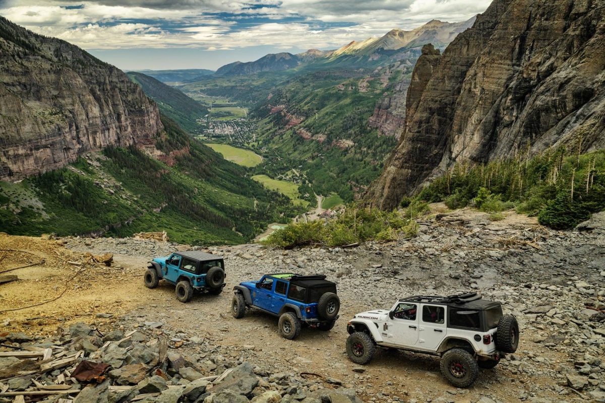
On Tuesday went up Imogene Pass. Going up the Telluride side the trail is pretty simple, though there is one long narrow shelf section with a long shear drop. After Black Bear Pass my wife had no issues with the shelves. Though we did joke about how most of the shelf roads have the passenger on the cliff side. A short stop at Smuggler’s Union Mine and a longer one at the Tomboy ghost town. There is so much cool historic mining stuff in the area, though the harsh winters at 11k+ feet are taking their toll.
The view from the top is just stunning, and there’s plenty of room to park so you don’t have to feel guilty about staying as long as you like. The descent down into Ouray offers several fun obstacles; the more difficult ones have bypasses for less adventurous drivers. None of them are super difficult, at least not when dry. They may be a bit more sketchy when wet and slippery. Don’t forget to stop and get a pic from Poser Rock.

Wednesday we headed to Poughkeepsie Gulch, via Mineral Creek. Poughkeepsie and Mineral Creek are different from a lot of the trails in the area in that they are more technical in nature. The scenery is all Colorado, but the trails have a bit more of a Moab feel to them with many larger rock obstacles.
Poughkeepsie gets fun when you take the fork that goes to The Wall. The Wall offers a bit more technical challenge than most of the trails in the area. When we were there, it was pretty dry, so no one in our group had any issues with any of the obstacles. The difficulty level can increase significantly when it is wet, and the rocks are slippery. Beware, for those who decide to go out to the wall and then opt out, there is no longer a bypass. What I believe was the bypass is now blocked off.
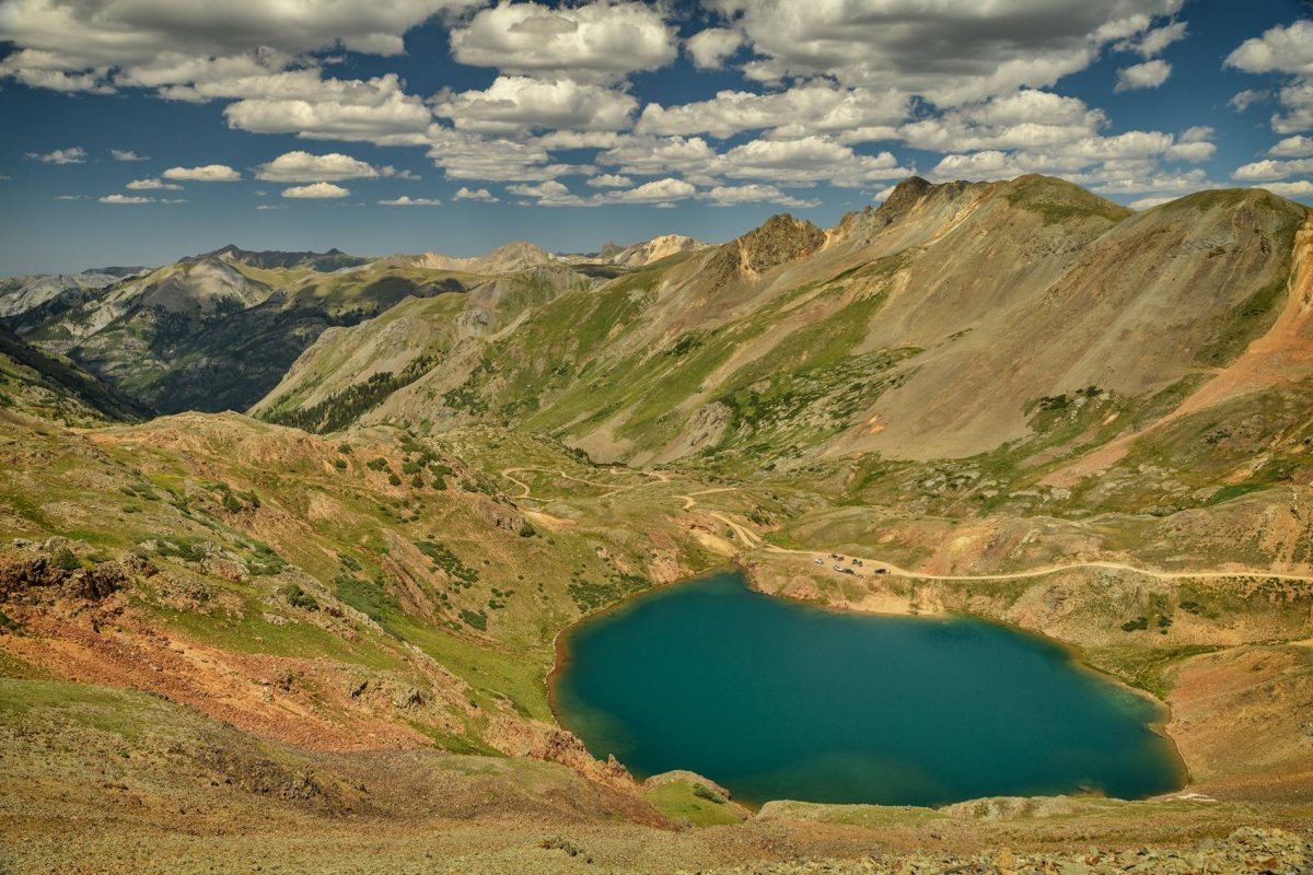
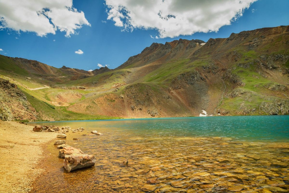
After The Wall there were a couple more fun obstacles before we rejoined the main trail. A bit further up is Lake Como, a beautiful turquoise blue high alpine lake. We stopped for a bit to take in the beauty.
On Thursday we drove down to Durango so my wife could get a tatoo to commemorate the trip. Tatoos aren’t really my thing, but the one she got is pretty cool. To get back to Durango we took the long way back going up the Million Dollar Hwy up through Ouray and then around back to Telluride.
On our way home my wife and I agreed this was by far the best trip we have ever taken in our 25 years. I want to thank @SadRobot and @arnie_mueller for inviting us to join them and letting us tag along. We had a fabulous time. It was indeed a trip we will never forget!
